Software, Equipment and Methods
Turtle locations are downloaded daily into Mapsource, a Garmin program that came with the GPS. It takes litterally seconds to transfer all turtle location waypoints, and any tracks collected during the day, into Mapsource via USB cable.
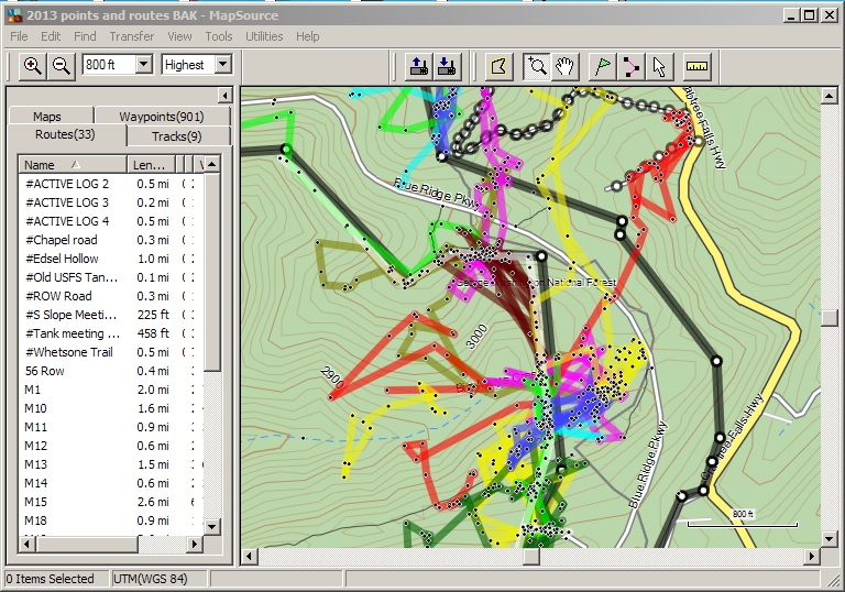
Mapsource is not a GIS but can accurately plot wayponts onto a topo map of the study area, and easily allows the construction of routes, which for this purpose, are accurate visualizations of turtle movements over the season to date.
Any turtle route can be viewed separately if desired and the map can be zoomed. Wayponts, routes and tracks can be edited if needed. Turtle movements (routes) give a lot of up-to-date information, including direction trends, which really helps in planning tracking, especially for fast moving individuals and when tracking activity is sporatic.
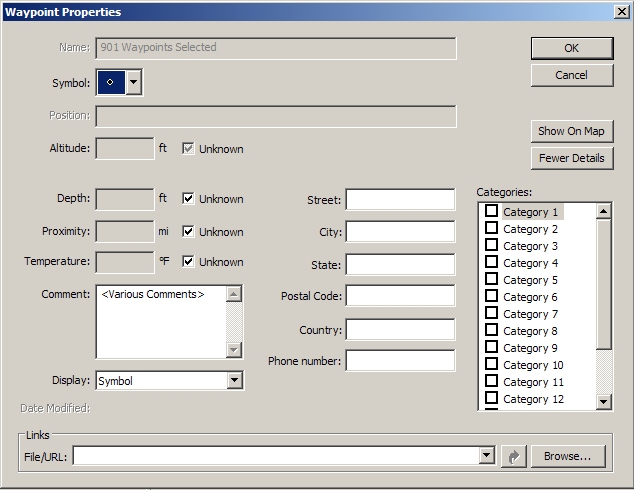
Mapsource is not a complicated program to use, but there are a few tricks that make viewing and data use easier. The graphic on the left is one of the most important screens.
When wayponts are downloaded from a GPS, they appear on the screen as a symbol, which was selected on the GPS, along with the waypoint ID (i.e. M11-65). If left this way, the screen quickly gets cluttered and unreadable. This is solved easily (although it took a long time to find), by selecting all waypoints in the main waypoint tab, right-clicking, and selecting waypoint properties. Change "Display" to "Symbol" and "Symbol" to a point or other small object.
Unbelievably, Mapsource cannot save wayponts, routes and tracks in shapefile (.shp) format. Mapsource CAN save files as .DXF, .GPX, and .MPS files. EDRISI shapefiles are preferred, so for this I use a separate step to save routes as shapefiles (one shapefile for each turtle = 1 layer).
First , in Mapsource select which routes are desired (no need to select route waypoints - that's done already), and UPLOAD them back into a GPS receiver. I have a spare unit that I keep clear of wayponts and routes. They appear on the GPS route screen.
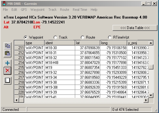
Next DOWNLOAD these routes from the GPS into the program, DNR Garmin, available free on the web. It uses the same USB cable and drivers as Mapsource and takes only seconds to receive the data. Follow the simple instructions to save each route to a separate shapefile (.shp).
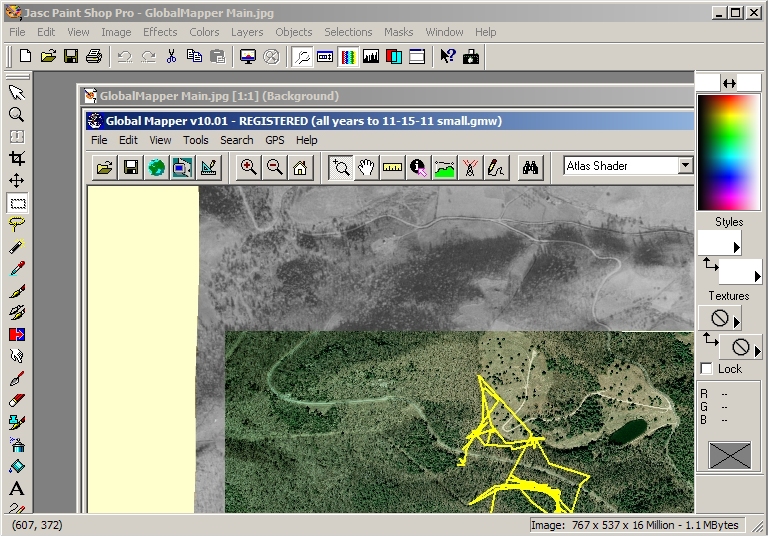
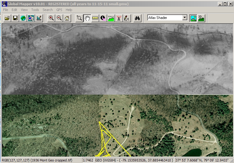
Global Mapper is the GIS program that I have become used to. ARCVIEW and other high-end GIS programs are much too tedious and expensive when only a few features are going to be used anyway.
Using Global Mapper, maps and aerial photos can be accurately geo-referrenced and saved for use as separate layers.
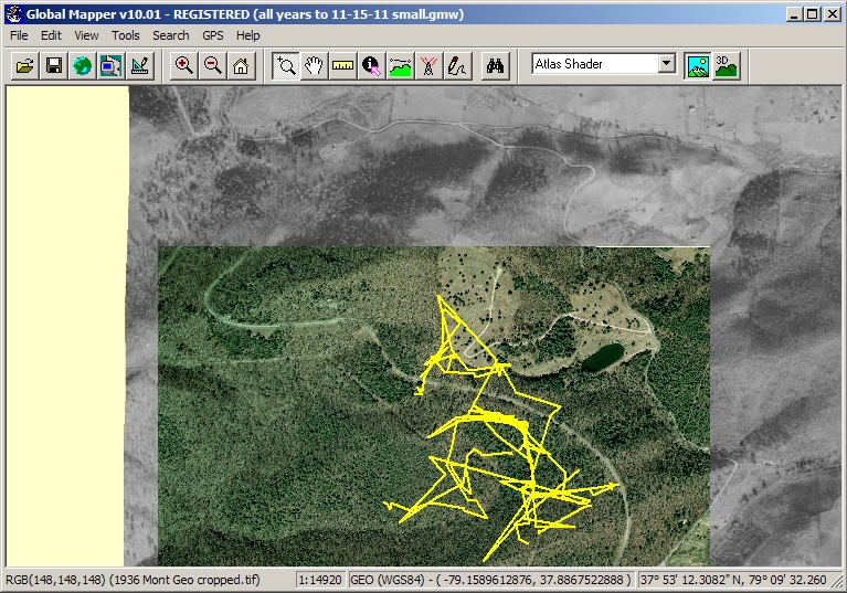
The graphic on the left has geo-referrenced 1936 and current aerial photos superimposed, along with several turtles routes.
As with any GIS, maps, aerials, and features such as routes are loaded en-mass, and can be switched on and off as desired.
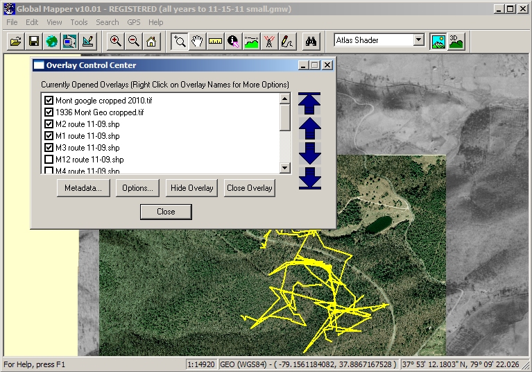
Layers in Global Mapper are termed Overlays, and are all in one place: the Control Center.
Any map or aerial photo can be made partially transparent. Routes and other features can be customized for width, color, and lots of other properties.
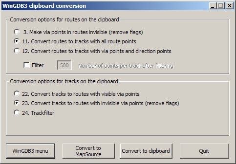
Here is another one of those tricks for efficiently using Mapsource.
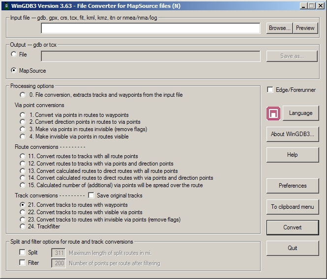
WinGDB3 is a free program to manipulate files for use in Mapsource. That's it's only function, and does it very well.
In "Clipboard Mode", WinGDB3 handles the most used, (and most useful) operations using only the Windows clipboard. Copy a route or track, or other mapsource feature, and this screen pops up. "Convert to Mapsource" completes the operation and opens up another instance of Mapsource and displays the features there.
There is no other way to do the conversions that WinGDB3 can do.
Accurately geo-referencing scanned digital maps and aerial photos is essential, and can be done inside Global Mapper, and probably any other GIS program. To geo-reference an aerial photo, several widely spaced landmarks on the photo must be visible on a map or on the ground and GPS'ed. Landmarks of very old photos can be difficult to recognize and locate.
Aerial photos are sometimes available from as far back as 1936, but even much more recent aerials (air photos) can be difficult to find and digitize. Most historic aerial photos, once considered to have a limited useful lifetime, have been destroyed. This type of historic documentation, once destroyed, can never be reconstructed.
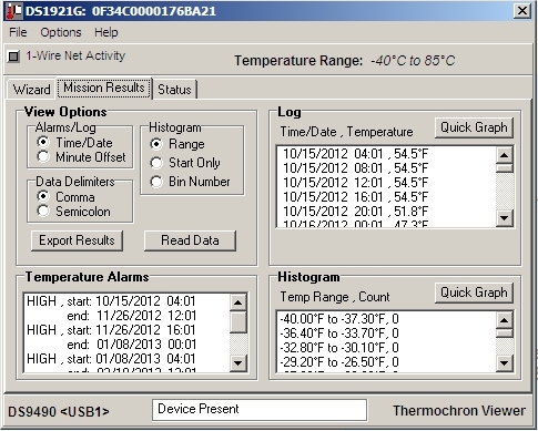
FYI. Onset's Boxcar is the program that is used to configure Hobo data loggers, to retrieve recorded data, and display data. The extensive line of serial data loggers are getting difficult to find, but the USB versions, using Onset's Hoboware are available.
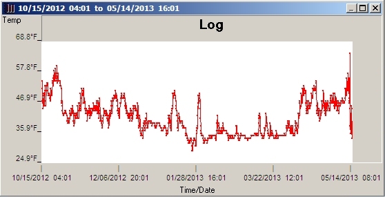
Data can be saved in several formats, including Excel .xls spreadsheet files, for data reduction and charting.
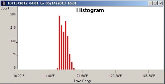
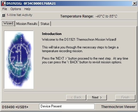
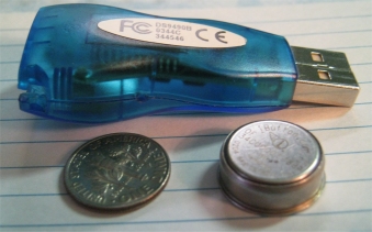
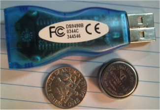
The iButton reader/writer, free configuration/reading software and one or more iButton Thermochrons are the complete package. Nothing else is needed, except a spreadsheet or charting program.
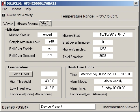
Thermochrons have a built-in lithium battery, which is good for about 10 years service or storage, and is sealed against moisture. The case is corrosion resistant so it can survive many many months in the soil without damage. They DO eventually go bad, so for critical applicatons, a backup might be preferred.
The software is available for several platforms, including a Palm version (using a RS232 serial reader) in case downloading data or reconfiguring is needed in the field. (Palm III's are available on Ebay for less than $10)
Thermochron Temperature Loggers
Mapsource can not display bitmaps as a background layer, so aerial photos can not be used
Terrapene carolina carolina